
 opez Island is rich with beautiful state parks and scenic, rugged coastline. Some of these unique spaces have been preserved through the San Juan County Land Bank. Following are some favorite destinations and a slideshow gallery to enjoy these natural landscapes.
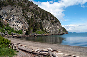 Watmough Bay is a small beach with an intimate feel. Accessed by a charming and easy 5-minute walk along a wide, level path through lush woods, the beach is a mix of sand and stones. Despite the level approach to the beach, the bay is sheltered on two sides by steep cliffs, and the water is calm and protected. This day-use site is maintained by the Bureau of Land Management, and has a basic pit toilet at the trailhead. Watmough Bay has been designated an Area of Critical Environmental Concern, and users are asked to comply with some basic guidelines. Camping, cycles and fires are prohibited, but dogs are allowed if leashed. Public use of the site is the result of a donation by the Oles Family to the Bureau of Land Management (BLM), as well as the agency’s later acquisition of part of the bay and its freshwater wetland. These combined efforts bring the total area maintained by the BLM to nearly 80 acres. Standard Leave No Trace principles apply in this very special area.Back to top
Directions:
Head down Paradise Road and turn Left onto Vista Road (1.2 m).
At the T intersection take a right onto Mud Bay Road (2.4 m).
Turn right onto Aleck Bay Road (.5 m).
Stay straight as the road turns into Watmough Head Road (.1m).
Take the first left to continue on Watmough Head Road (.5 m).
Turn left at the sign for Watmough Bay (.1m).
 Parking for these two beautiful beach sites is a small pull-off on the left-hand side of the road. A small island off shore at Agate Beach can be accessed on foot at low tide. Reach the beach by descending a flight of stairs, and take in the sweeping view of open water, neighboring islands, and the distant Olympic Peninsula. Despite its name, this site has been well combed by rock hunters–but with some well-focused attention, you might get lucky and find an agate of your own.Back to top
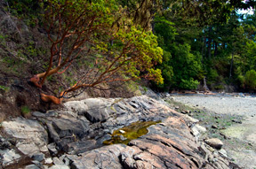
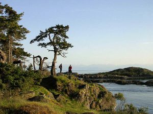
 This wind-swept hilltop walk brings you close to wild wide of Lopez Island. From the parking area at Agate Point, continue on foot .1 mile south by road to a sign identifying Bat and Ball Lane on your left. A long pole gate on the right marks the entry path to Iceberg Point. Turn right onto this lane, where an easy ten-minute walk brings you out of protective forest and into the coastal wilds of this wind-swept site. A reserve encompassing close to 80 acres, Iceberg Point features tall blowing grasses throughout the year and fields of delicate wildflowers in the spring. A mile and a half of established trails, maintained by the Bureau of Land Management, lead to a hillock topped by a white stone monument. This elevated destination offers the best view of the area: sweeping panoramas of the island’s scenic coast, across nearby islands, and all the way across the straits to the snowcapped mountains of the Olympic Peninsula.Back to top
Directions:
Head down Paradise Road and turn Left onto Vista Road (1.2 m).
At the T intersection take a right onto Mud Bay Road (1.1 m).
Turn right on MacKaye Harbor Road and follow it until you reach the Agate Beach parking lot (1.7 m).
 A tombolo is gravel or sand bar connecting a piece of land to an island. Lopez Island’s tombolo connects an island to an island and its surrounding tidal flats and shoreline provide habitat for numerous wildlife, waterfowl and marine organisms. Back to top
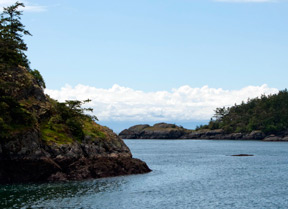
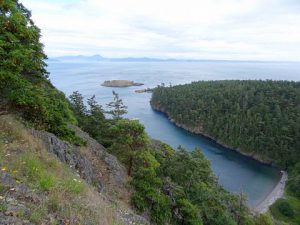
 Just a short hike from the county road brings you to rugged shoreline and views across the San Juan Channel toward the Olympic Mountains. The park offers a variety of bird and marine life. Gray Whales are occasionally spotted off shore and seals are regular seen swimming throughout the reef. Back to top
 Hike up to the 470-foot summit of Chadwick Hill, Lopez Island’s second highest peak, for some amazing views over Rosario Strait, then beachcomb at one of Lopez’s popular beaches located on Watmough Bay. Back to top